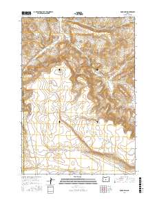
2017 Map of Rodman Rim
USGS Topo · Published 2017About this map
Rodman Rim defines the central topography of this high desert landscape on the boundary of Deschutes and Crook counties. The area is characterized by a network of drainage systems and intermittent water sources, most notably the winding path of the Dry River in the south and the Houston Reservoir Number One. This 2017 survey reflects a sparsely populated ranching or conservation environment where connectivity is provided by utilitarian routes like Bear Creek-Fife Rd and Merrill Rd. Water remains the primary geographical anchor in this arid region, evidenced by the presence of Little Bear Cr and Bear Cr tucked into the northern and eastern breaks of the rim.
Find a feature on this map
11 named features on this map. Tap any name to fly to it.
Don’t see what you’re looking for? This feature index may not catch every label — zoom into the map to look around manually.
Map Details
Editions of this 2017 Rodman Rim Map
This is the sole edition of this map. No revisions or reprints were ever made.
Other maps of this area

1946 · Eagle Rock
USGS Topo · 1:62,500

1948 · Eagle Rock
USGS Topo · 1:62,500

1955 · Crescent
USGS Topo · 1:250,000

1955 · Bend
USGS Topo · 1:250,000

1957 · Crescent
USGS Topo · 1:250,000

1957 · Bend
USGS Topo · 1:250,000

1958 · Crescent
USGS Topo · 1:250,000

1958 · Bend
USGS Topo · 1:250,000

1962 · Powell Buttes
USGS Topo · 1:62,500

1966 · Millican SE
USGS Topo · 1:24,000