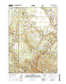
2014 Map of Rodman Rock
USGS Topo · Published 2014About this map
The high timberlands of the Fremont National Forest and Winema National Forest meet in this 2014 survey, highlighting a landscape defined by volcanic landforms and scattered water sources. Centered on the boundary between Klamath and Lake counties, the area is punctuated by prominent elevations such as McCarty Butte and Dillon Butte. The map details a complex network of forest development roads, including Bear Flat Rd and Natl Forest Develop Road 2878 Rd, which provide access to essential backcountry resources like Trapper Spring and Coffeepot Spring. The presence of open clearings like McCarty Field and Antelope Flat among the dense forest cover reflects the region's character as a managed wilderness area where water bodies like Antelope Lake and Bear Cr support the local ecosystem.
Find a feature on this map
35 named features on this map. Tap any name to fly to it.
Don’t see what you’re looking for? This feature index may not catch every label — zoom into the map to look around manually.
Map Details
Editions of this 2014 Rodman Rock Map
This is the sole edition of this map. No revisions or reprints were ever made.
Other maps of this area

1889 · Klamath
USGS Topo · 1:250,000

1894 · Klamath
USGS Topo · 1:250,000

1955 · Crescent
USGS Topo · 1:250,000

1955 · Klamath Falls
USGS Topo · 1:250,000

1957 · Crescent
USGS Topo · 1:250,000

1958 · Crescent
USGS Topo · 1:250,000

1958 · Klamath Falls
USGS Topo · 1:250,000

1960 · Sycan Marsh
USGS Topo · 1:62,500

1960 · Yamsay Mountain
USGS Topo · 1:62,500

1968 · Location Butte
USGS Topo · 1:24,000