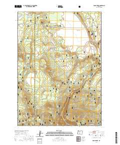
2020 Map of Rodman Rock
USGS Topo · Published 2020About this map
The high volcanic plateau of the Oregon Cascades defines this area, where the Fremont National Forest and Winema National Forest meet along the boundary of Klamath and Lake counties. The terrain is characterized by prominent basaltic outcrops and cinder cones, most notably Rodman Rock, McCarty Butte, and Dillon Butte. This 2020 landscape remains largely defined by its water sources, which are critical in this arid timberland. Named springs such as Bear Spring, Still Spring, Trapper Spring, and Boundary Spring dot the forest floor, feeding a network of seasonal drainages like Rock Creek and Buck Creek. Open areas like Antelope Flat and McCarty Field punctuate the dense canopy, providing clearings that have long served as landmarks for forestry and range management. The map also shows Antelope Lake, a significant water body in the northern portion of the quadrangle, situated near Little Antelope Flat.
Find a feature on this map
35 named features on this map. Tap any name to fly to it.
Don’t see what you’re looking for? This feature index may not catch every label — zoom into the map to look around manually.
Map Details
Editions of this 2020 Rodman Rock Map
This is the sole edition of this map. No revisions or reprints were ever made.
Other maps of this area

1889 · Klamath
USGS Topo · 1:250,000

1894 · Klamath
USGS Topo · 1:250,000

1955 · Crescent
USGS Topo · 1:250,000

1955 · Klamath Falls
USGS Topo · 1:250,000

1957 · Crescent
USGS Topo · 1:250,000

1958 · Crescent
USGS Topo · 1:250,000

1958 · Klamath Falls
USGS Topo · 1:250,000

1960 · Sycan Marsh
USGS Topo · 1:62,500

1960 · Yamsay Mountain
USGS Topo · 1:62,500

1968 · Location Butte
USGS Topo · 1:24,000