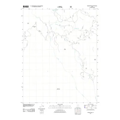
2011 Map of Roger Peak
USGS Topo · Published 2011About this map
Roger Peak and the high ridges of Garfield County define this high-altitude landscape. The map centers on the dramatic relief of Hells Backbone Ridge, where the historic Hells Backbone Rd traverses a narrow divide between steep drainages. To the south, the terrain falls away into the Right Fork Death Hollow, while the northern portion is marked by alpine water bodies like Donkey Lake and Mcgath Lake.
Find a feature on this map
16 named features on this map. Tap any name to fly to it.
Don’t see what you’re looking for? This feature index may not catch every label — zoom into the map to look around manually.
Map Details
Editions of this 2011 Roger Peak Map
This is the sole edition of this map. No revisions or reprints were ever made.
Other maps of this area

1885 · Fish Lake
USGS Topo · 1:250,000

1886 · Escalante
USGS Topo · 1:250,000

1896 · Fish Lake
USGS Topo · 1:250,000

1952 · Notom 3 SW
USGS Topo · 1:24,000

1952 · Grover
USGS Topo · 1:62,500

1956 · Escalante
USGS Topo · 1:250,000

1956 · Salina
USGS Topo · 1:250,000

1960 · Escalante
USGS Topo · 1:250,000

1960 · Salina
USGS Topo · 1:250,000

1962 · Salina
USGS Topo · 1:250,000