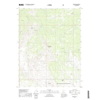
2020 Map of Roger Peak
USGS Topo · Published 2020About this map
Roger Peak and the surrounding Garfield County highlands are defined by a complex network of high-elevation drainages and precipitous ridges. This 2020 landscape transitions from the protected timberlands of the Dixie National Forest in the north to the canyon systems of the Grand Staircase-Escalante National Monument in the south. The dramatic terrain is etched by Death Hollow and its Right Fork, while high points like Mt Ogden overlook the sweeping King Bench and Slickrock Saddle Bench. Transportation through this steep country relies on established routes such as Hells Backbone Rd and the Great Western Trail. Notable water features including Donkey Lake and Lake Cr provide essential resources in a region characterized by deep sandstone fissures and exposed plateau tops.
Find a feature on this map
23 named features on this map. Tap any name to fly to it.
Don’t see what you’re looking for? This feature index may not catch every label — zoom into the map to look around manually.
Map Details
Editions of this 2020 Roger Peak Map
This is the sole edition of this map. No revisions or reprints were ever made.
Other maps of this area

1885 · Fish Lake
USGS Topo · 1:250,000

1886 · Escalante
USGS Topo · 1:250,000

1896 · Fish Lake
USGS Topo · 1:250,000

1952 · Notom 3 SW
USGS Topo · 1:24,000

1952 · Grover
USGS Topo · 1:62,500

1956 · Escalante
USGS Topo · 1:250,000

1956 · Salina
USGS Topo · 1:250,000

1960 · Escalante
USGS Topo · 1:250,000

1960 · Salina
USGS Topo · 1:250,000

1962 · Salina
USGS Topo · 1:250,000