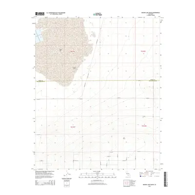
2015 Map of Rogers Lake South
USGS Topo · Published 2015About this map
Rogers Lake dominates the northwestern corner of this high-desert landscape, its expansive dry bed serving as a primary focal point within the broader Mojave Desert. The map documents a critical boundary area where the Kern Co Los Angeles Co line bisects the terrain, illustrating the grid-like expansion of regional infrastructure into the arid plains. Roads such as N Mercury Blvd and Mercury Blvd provide primary north-south transit, while a series of alphabetically designated avenues, including E Avenue A and E Avenue E, underscore the geometric precision of local land division. To the southeast, the topography rises toward the prominent elevation of Mt Mesa, contrasting the flat, salt-crusted lakebed to the north. This survey provides a clear look at the intersection of municipal boundaries and desert geography in the mid-2010s.
Find a feature on this map
24 named features on this map. Tap any name to fly to it.
Don’t see what you’re looking for? This feature index may not catch every label — zoom into the map to look around manually.
Map Details
Editions of this 2015 Rogers Lake South Map
This is the sole edition of this map. No revisions or reprints were ever made.
Other maps of this area

1930 · Joshua
USGS Topo · 1:24,000

1931 · Hi Vista
USGS Topo · 1:24,000

1934 · Joshua
USGS Topo · 1:24,000

1935 · Hi Vista
USGS Topo · 1:24,000

1937 · Shadow Mountains
USGS Topo · 1:48,000

1937 · Kramer
USGS Topo · 1:48,000

1937 · Rogers Lake
USGS Topo · 1:48,000

1942 · Kramer
USGS Topo · 1:62,500

1942 · Shadow Mountains
USGS Topo · 1:62,500

1942 · Rogers Lake
USGS Topo · 1:62,500