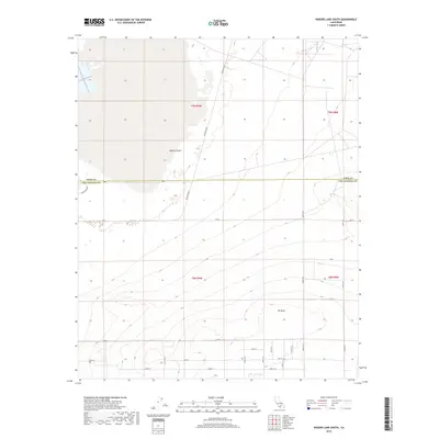
2018 Map of Rogers Lake South
USGS Topo · Published 2018About this map
Mojave Desert terrain dominates this landscape along the border of Kern and Los Angeles Counties, where the high desert is meticulously subdivided by an extensive grid of planned roads. The terrain transitions from the dry expanse in the north to the rising elevation of Mt Mesa in the south. The rectilinear road system, including primary corridors like Mercury Blvd and Lancaster Blvd, indicates a period of rural development and land partitioning characteristic of this portion of the Antelope Valley. While the map is sparse of concentrated settlements, the precise numbering of township and range lines, such as t9n r9w, provides a critical framework for property research and historical land-use studies in this arid region.
Find a feature on this map
26 named features on this map. Tap any name to fly to it.
Don’t see what you’re looking for? This feature index may not catch every label — zoom into the map to look around manually.
Map Details
Editions of this 2018 Rogers Lake South Map
This is the sole edition of this map. No revisions or reprints were ever made.
Other maps of this area

1930 · Joshua
USGS Topo · 1:24,000

1931 · Hi Vista
USGS Topo · 1:24,000

1934 · Joshua
USGS Topo · 1:24,000

1935 · Hi Vista
USGS Topo · 1:24,000

1937 · Shadow Mountains
USGS Topo · 1:48,000

1937 · Kramer
USGS Topo · 1:48,000

1937 · Rogers Lake
USGS Topo · 1:48,000

1942 · Kramer
USGS Topo · 1:62,500

1942 · Shadow Mountains
USGS Topo · 1:62,500

1942 · Rogers Lake
USGS Topo · 1:62,500