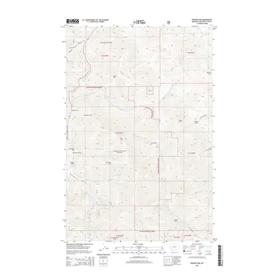
2014 Map of Rogers Pass
USGS Topo · Published 2014About this map
Rogers Pass serves as a critical high-altitude point within the Lewis and Clark Range, marking the drainage divide where the Middle Fork Dearborn River and S Fork Dearborn River flow eastward toward the Missouri, while the Blackfoot River begins its westward journey. This 2014 survey reveals a landscape defined by significant elevation changes, from the heights of Rittel Mtn and Sunset Mtn down to the complex drainage systems of Chambers Gulch and Dark Gulch. Much of the territory is managed as part of the Helena National Forest, though the presence of private mining-related interests is indicated by the Mike Horse area and Anaconda Hill. Local infrastructure is sparse, consisting primarily of forest routes like Sister Rd and Mike Horse Creek Rd, reflecting the area's primary functions as a corridor for watershed management and mineral history.
Find a feature on this map
50 named features on this map. Tap any name to fly to it.
Don’t see what you’re looking for? This feature index may not catch every label — zoom into the map to look around manually.
Map Details
Editions of this 2014 Rogers Pass Map
This is the sole edition of this map. No revisions or reprints were ever made.
Other maps of this area

1889 · Helena
USGS Topo · 1:250,000

1893 · Helena
USGS Topo · 1:250,000

1899 · Helena
USGS Topo · 1:250,000

1903 · Helena
USGS Topo · 1:250,000

1943 · Hogan
USGS Topo · 1:125,000

1947 · Butte
USGS Topo · 1:250,000

1955 · Choteau
USGS Topo · 1:250,000

1957 · Choteau
USGS Topo · 1:250,000

1958 · Butte
USGS Topo · 1:250,000

1958 · Choteau
USGS Topo · 1:250,000