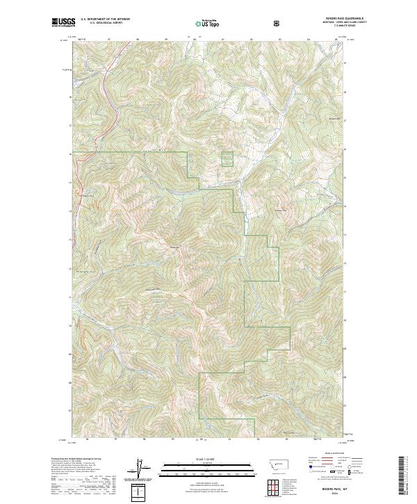
2024 Map of Rogers Pass
USGS Topo · Published 2024About this map
Rogers Pass and the rugged drainage of the Middle Fork Dearborn River define the high country along the Continental Divide in this recent topographic study. The landscape is characterized by the complex water systems flowing from the divide, including Teepee Lodge Creek, Anaconda Creek, and the West Prong Dearborn River. This area represents a critical junction of protected lands, spanning the Helena National Forest and the Blackfoot Valley Conservation Area, where the Continental Divide National Scenic Trl traverses the crest of the mountains.
Find a feature on this map
51 named features on this map. Tap any name to fly to it.
Don’t see what you’re looking for? This feature index may not catch every label — zoom into the map to look around manually.
Map Details
Editions of this 2024 Rogers Pass Map
This is the sole edition of this map. No revisions or reprints were ever made.
Other maps of this area

1889 · Helena
USGS Topo · 1:250,000

1893 · Helena
USGS Topo · 1:250,000

1899 · Helena
USGS Topo · 1:250,000

1903 · Helena
USGS Topo · 1:250,000

1943 · Hogan
USGS Topo · 1:125,000

1947 · Butte
USGS Topo · 1:250,000

1955 · Choteau
USGS Topo · 1:250,000

1957 · Choteau
USGS Topo · 1:250,000

1958 · Butte
USGS Topo · 1:250,000

1958 · Choteau
USGS Topo · 1:250,000