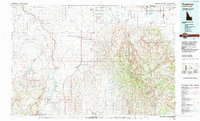
1992 Map of Rogerson
USGS Topo · Published 1992About this map
The high desert and mountain landscapes of southern Idaho and northern Nevada are defined here by the water-management systems and transportation corridors of the late twentieth century. Salmon Falls Creek Reservoir and the Cedar Creek Reservoir dominate the western terrain, serving an agricultural network of canals and small settlements like Rogerson, Hollister, and Amsterdam. This region is bisected by the Union Pacific railroad and U.S. Route 93, which follow the gentle grades through the Shoshone Basin before the land rises sharply into the timbered heights of the Sawtooth National Forest.
Find a feature on this map
54 named features on this map. Tap any name to fly to it.
Don’t see what you’re looking for? This feature index may not catch every label — zoom into the map to look around manually.
Map Details
Editions of this 1992 Rogerson Map
This is the sole edition of this map. No revisions or reprints were ever made.
Other maps of this area

1950 · Filer
USGS Topo · 1:24,000

1950 · Jerome
USGS Topo · 1:62,500

1951 · Clover
USGS Topo · 1:24,000

1954 · Pocatello
USGS Topo · 1:250,000

1954 · Brigham City
USGS Topo · 1:250,000

1955 · Twin Falls
USGS Topo · 1:250,000

1955 · Wells
USGS Topo · 1:250,000

1957 · Contact
USGS Topo · 1:62,500

1957 · Delaplain
USGS Topo · 1:62,500

1957 · Elk Mountain
USGS Topo · 1:62,500