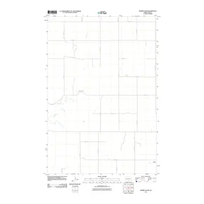
2011 Map of Rohrich Dam
USGS Topo · Published 2011About this map
Clear Creek winds through this expanse of Emmons County, defining the drainage patterns across a highly structured agricultural landscape. The area is surveyed into a precise grid of rural roads, including 15th Ave SE and 80th St SE, which facilitate access to the surrounding farmsteads. Two small, isolated burial grounds serve as quiet landmarks for local genealogists and family historians: Omio Cemetery is situated in the central portion of the quadrangle, while Martins Cemetery lies near the southeastern corner. These sites, along with the meandering path of the creek, provide the primary points of orientation within the expansive prairie terrain of south-central North Dakota.
Find a feature on this map
19 named features on this map. Tap any name to fly to it.
Don’t see what you’re looking for? This feature index may not catch every label — zoom into the map to look around manually.
Map Details
Editions of this 2011 Rohrich Dam Map
This is the sole edition of this map. No revisions or reprints were ever made.
Other maps of this area

1953 · Jamestown
USGS Topo · 1:250,000

1954 · Bismarck
USGS Topo · 1:250,000

1956 · Jamestown
USGS Topo · 1:250,000

1958 · Bismarck
USGS Topo · 1:250,000

1971 · Strasburg
USGS Topo · 1:24,000

1975 · Appert Lake
USGS Topo · 1:24,000

1975 · Linton NE
USGS Topo · 1:24,000

1979 · Senger Lake North
USGS Topo · 1:24,000

1979 · Schell Buttes SW
USGS Topo · 1:24,000

1979 · Schell Buttes NW
USGS Topo · 1:24,000