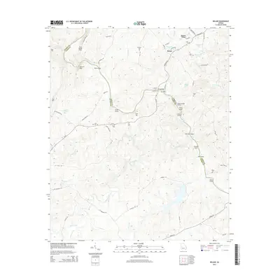
2014 Map of Roland
USGS Topo · Published 2014About this map
The Flint River carves a winding path through the border of Talbot and Upson counties, creating a landscape of prominent ridges and named shoals. Significant river features like Sprewell Bluff and Yellow Jacket Shoals define the waterway's character, while numerous islands including Owens Island and Gibson Island dot the channel. The area's settlement pattern is largely rural, anchored by the community of Roland and the residential layout of Sunset Village.
Find a feature on this map
70 named features on this map. Tap any name to fly to it.
Don’t see what you’re looking for? This feature index may not catch every label — zoom into the map to look around manually.
Map Details
Editions of this 2014 Roland Map
This is the sole edition of this map. No revisions or reprints were ever made.
Other maps of this area

1907 · Talbotton
USGS Topo · 1:125,000

1934 · Warm Springs
USGS Topo · 1:62,500

1935 · Thomaston
USGS Topo · 1:48,000

1936 · Warm Springs
USGS Topo · 1:62,500

1939 · Thomaston
USGS Topo · 1:62,500

1950 · Talbotton
USGS Topo · 1:24,000

1950 · Talbotton
USGS Topo · 1:62,500

1955 · Talbotton
USGS Topo · 1:24,000
1955 · Talbotton
USGS Topo · 1:62,500

1955 · Phenix City
USGS Topo · 1:250,000