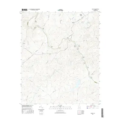
2017 Map of Roland
USGS Topo · Published 2017About this map
The Flint River carves a deep path through the borderlands of Talbot and Upson counties, creating a landscape defined by dramatic river features and isolated agricultural settlements. At Yellow Jacket Shoals, the water breaks over rocky terrain, passing significant river landmarks like Ivy Island, Noel Island, and the cluster known as Seven Islands. The upland areas are anchored by small communities such as Roland and Sunset Village, while the surrounding timberlands and ridges, including Pine Mtn and Oak Mtn, show a network of rural roads such as Adams Ferry Rd and Pobiddy Rd. Genealogists will find several family and community burial grounds well-documented across the quadrangle, from Grantland Cem in the north to Brown Cem and Adams Cem further south, offering a precise look at the historic settlement patterns of this river valley.
Find a feature on this map
79 named features on this map. Tap any name to fly to it.
Don’t see what you’re looking for? This feature index may not catch every label — zoom into the map to look around manually.
Map Details
Editions of this 2017 Roland Map
This is the sole edition of this map. No revisions or reprints were ever made.
Other maps of this area

1907 · Talbotton
USGS Topo · 1:125,000

1934 · Warm Springs
USGS Topo · 1:62,500

1935 · Thomaston
USGS Topo · 1:48,000

1936 · Warm Springs
USGS Topo · 1:62,500

1939 · Thomaston
USGS Topo · 1:62,500

1950 · Talbotton
USGS Topo · 1:24,000

1950 · Talbotton
USGS Topo · 1:62,500

1955 · Talbotton
USGS Topo · 1:24,000
1955 · Talbotton
USGS Topo · 1:62,500

1955 · Phenix City
USGS Topo · 1:250,000