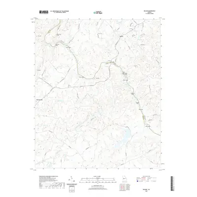
2020 Map of Roland
USGS Topo · Published 2020About this map
Flint River dominates the landscape as it winds between Talbot and Upson counties, defining a terrain shaped by ridges and river islands. The settlement at Roland sits north of where the river creates distinctive features like Yellow Jacket Shoals and Hightower Shoals, while several small islands, including Ivy Island, Gibson Island, and Noel Island, appear within the main channel. Historically significant crossings are marked by Wynns Bridge and Adams Ferry Rd.
Find a feature on this map
80 named features on this map. Tap any name to fly to it.
Don’t see what you’re looking for? This feature index may not catch every label — zoom into the map to look around manually.
Map Details
Editions of this 2020 Roland Map
This is the sole edition of this map. No revisions or reprints were ever made.
Other maps of this area

1907 · Talbotton
USGS Topo · 1:125,000

1934 · Warm Springs
USGS Topo · 1:62,500

1935 · Thomaston
USGS Topo · 1:48,000

1936 · Warm Springs
USGS Topo · 1:62,500

1939 · Thomaston
USGS Topo · 1:62,500

1950 · Talbotton
USGS Topo · 1:24,000

1950 · Talbotton
USGS Topo · 1:62,500

1955 · Talbotton
USGS Topo · 1:24,000
1955 · Talbotton
USGS Topo · 1:62,500

1955 · Phenix City
USGS Topo · 1:250,000