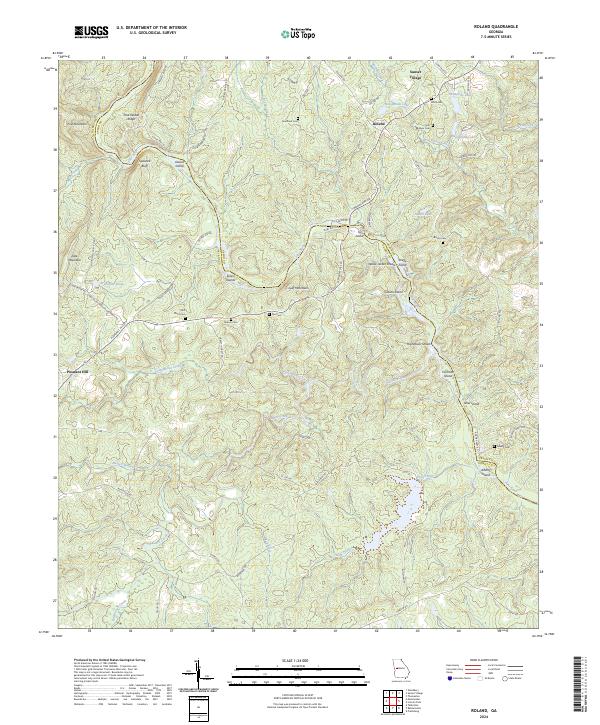
2024 Map of Roland
USGS Topo · Published 2024About this map
The Flint River carves a deep, winding course through the borderlands of Talbot and Upson Counties, defining a landscape marked by dramatic riverine features. This reach is notable for its numerous named shoals and river islands, including Yellow Jacket Shoals, Hightower Shoals, and several larger landforms like Owens Island and Gibson Island. The river's path is constrained by significant terrain features such as Sprewell Bluff and Pine Mountain, creating a complex topography that has historically influenced the placement of local settlements and infrastructure.
Find a feature on this map
77 named features on this map. Tap any name to fly to it.
Don’t see what you’re looking for? This feature index may not catch every label — zoom into the map to look around manually.
Map Details
Editions of this 2024 Roland Map
This is the sole edition of this map. No revisions or reprints were ever made.
Other maps of this area

1907 · Talbotton
USGS Topo · 1:125,000

1934 · Warm Springs
USGS Topo · 1:62,500

1935 · Thomaston
USGS Topo · 1:48,000

1936 · Warm Springs
USGS Topo · 1:62,500

1939 · Thomaston
USGS Topo · 1:62,500

1950 · Talbotton
USGS Topo · 1:24,000

1950 · Talbotton
USGS Topo · 1:62,500

1955 · Talbotton
USGS Topo · 1:24,000
1955 · Talbotton
USGS Topo · 1:62,500

1955 · Phenix City
USGS Topo · 1:250,000