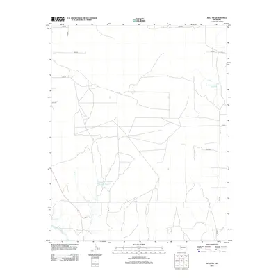
2012 Map of Roll NW
USGS Topo · Published 2012About this map
The Canadian River flows through the southwestern corner of this western Oklahoma landscape, defining the local hydrology alongside intermittent drainages and man-made impoundments. Significant water management is evident through the presence of the Bradshaw Number 1 Reservoir in the northeast and Bradshaw Number 2 Reservoir further south, which serve the surrounding agricultural lands. The terrain is dissected by Sand Cr and W Cr, while a strict grid of section-line roads, including e0700 RD and n1880 RD, organizes the rural territory. This survey reflects the modern infrastructure of Ellis County, where the historic path of the river remains the primary natural landmark against a backdrop of organized ranching or farming tracts.
Find a feature on this map
18 named features on this map. Tap any name to fly to it.
Don’t see what you’re looking for? This feature index may not catch every label — zoom into the map to look around manually.
Map Details
Editions of this 2012 Roll NW Map
This is the sole edition of this map. No revisions or reprints were ever made.
Other maps of this area

1955 · Clinton
USGS Topo · 1:250,000

1955 · Woodward
USGS Topo · 1:250,000

1957 · Clinton
USGS Topo · 1:250,000

1958 · Woodward
USGS Topo · 1:250,000

1965 · Roll NE
USGS Topo · 1:24,000

1965 · Roll NW
USGS Topo · 1:24,000

1965 · Crawford
USGS Topo · 1:24,000

1966 · Roll
USGS Topo · 1:24,000

1966 · Antelope Hills NE
USGS Topo · 1:24,000

1966 · Roll SE
USGS Topo · 1:24,000