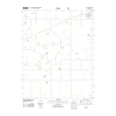
2011 Map of Rolla
USGS Topo · Published 2011About this map
Rolla serves as the primary hub of activity in this part of Morton County, situated at the intersection of local routes and the northern edge of expansive agricultural lands. The landscape is defined by its massive, numbered pasture blocks, reflecting the highly organized ranching and farming divisions of Southwest Kansas. To the north of the town center, Rolla Cemetery stands as a significant point for genealogists and local historians tracing the settlement's residents. The surrounding territory is partitioned into distinct named areas such as Tucker Pasture, Watson Pasture, and the South East Wilburton Pasture, illustrating the specific land-use patterns of the early 21st century. Infrastructure is laid out in a strict grid, with corridors like J Blvd and County Road C connecting the disparate agricultural holdings to the residential core of the township.
Find a feature on this map
14 named features on this map. Tap any name to fly to it.
Don’t see what you’re looking for? This feature index may not catch every label — zoom into the map to look around manually.
Map Details
Editions of this 2011 Rolla Map
This is the sole edition of this map. No revisions or reprints were ever made.
Other maps of this area

1954 · Perryton
USGS Topo · 1:250,000

1955 · Dodge City
USGS Topo · 1:250,000

1958 · Perryton
USGS Topo · 1:250,000

1958 · Dodge City
USGS Topo · 1:250,000

1959 · Dodge City
USGS Topo · 1:250,000

1973 · Rolla NW
USGS Topo · 1:24,000

1973 · Elkhart NE
USGS Topo · 1:24,000

1973 · Rolla NE
USGS Topo · 1:24,000

1973 · Hough NE
USGS Topo · 1:24,000

1973 · Hough NW
USGS Topo · 1:24,000