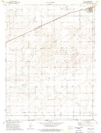
1974 Map of Rolla
USGS Topo · Published 1976About this map
The town of Rolla anchors the northeastern corner of this 1970s landscape, serving as a vital hub where the Atchison Topeka and Santa Fe railroad cuts diagonally across the High Plains. This era of the mid-1970s is defined by a dense grid of energy extraction, with dozens of Gas Well and Oil Well locations marking the subsurface wealth of Morton County. Beyond the town's center, where a prominent Water Tank and the Rolla Cem are situated, the map documents a vast network of underground pipelines that supported the region's petroleum industry. The terrain is relatively uniform, yet the industrial footprint of the Cimarron Rolla area shows a landscape thoroughly utilized for its natural resources during a period of significant domestic energy production.
Find a feature on this map
9 named features on this map. Tap any name to fly to it.
Don’t see what you’re looking for? This feature index may not catch every label — zoom into the map to look around manually.
Map Details
Editions of this 1974 Rolla Map
This is the sole edition of this map. No revisions or reprints were ever made.
Other maps of this area

1954 · Perryton
USGS Topo · 1:250,000

1955 · Dodge City
USGS Topo · 1:250,000

1958 · Perryton
USGS Topo · 1:250,000

1958 · Dodge City
USGS Topo · 1:250,000

1959 · Dodge City
USGS Topo · 1:250,000

1973 · Rolla NW
USGS Topo · 1:24,000

1973 · Elkhart NE
USGS Topo · 1:24,000

1973 · Rolla NE
USGS Topo · 1:24,000

1973 · Hough NE
USGS Topo · 1:24,000

1973 · Hough NW
USGS Topo · 1:24,000