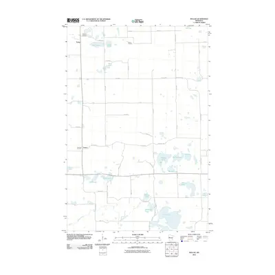
2010 Map of Rollag
USGS Topo · Published 2010About this map
Glacial prairie potholes and small rural communities define this portion of Clay County, Minnesota. The settlement of Rollag sits in the northwest corner, a focal point for a landscape characterized by family-named water bodies and local churchyards. Several historical burial grounds, including Grong Lutheran Cemetery, Bethany Cemetery, and Aspelund Cemetery, are distributed across the township, serving the nearby community of Tansem.
Find a feature on this map
43 named features on this map. Tap any name to fly to it.
Don’t see what you’re looking for? This feature index may not catch every label — zoom into the map to look around manually.
Map Details
Editions of this 2010 Rollag Map
This is the sole edition of this map. No revisions or reprints were ever made.
Other maps of this area

1914 · Pelican Rapids
USGS Topo · 1:62,500

1917 · Pelican Rapids
USGS Topo · 1:62,500

1919 · Barnesville
USGS Topo · 1:62,500

1919 · Hawley
USGS Topo · 1:62,500

1952 · Barnesville
USGS Topo · 1:62,500

1953 · Fargo
USGS Topo · 1:250,000

1956 · Fargo
USGS Topo · 1:250,000
1966 · Hawley SE
USGS Topo · 1:24,000
1966 · Big Cormorant Lake
USGS Topo · 1:24,000
1966 · Lake Park SW
USGS Topo · 1:24,000