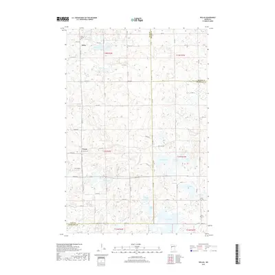
2019 Map of Rollag
USGS Topo · Published 2019About this map
Rollag and Tansem anchor this rural landscape where the prairie meets the lake-strewn glacial terrain of western Minnesota. The map reveals a high density of named water bodies, including the centrally located Dewey Lake and the interconnected waters of Grove Lake and Maple Lake to the south. For genealogists and local historians, the sheet is exceptionally detailed with respect to early community centers, marking several denominational burial grounds such as Grong Lutheran Cem and Aspelund Cem. A complex network of gravel and local roads, including 270th St S and 120th Ave S, follows the section lines of the Public Land Survey System, illustrating how agricultural development has navigated the region's irregular hydrography, from the winding Whisky Cr to isolated points like Coot Landing.
Find a feature on this map
68 named features on this map. Tap any name to fly to it.
Don’t see what you’re looking for? This feature index may not catch every label — zoom into the map to look around manually.
Map Details
Editions of this 2019 Rollag Map
This is the sole edition of this map. No revisions or reprints were ever made.
Other maps of this area

1914 · Pelican Rapids
USGS Topo · 1:62,500

1917 · Pelican Rapids
USGS Topo · 1:62,500

1919 · Barnesville
USGS Topo · 1:62,500

1919 · Hawley
USGS Topo · 1:62,500

1952 · Barnesville
USGS Topo · 1:62,500

1953 · Fargo
USGS Topo · 1:250,000

1956 · Fargo
USGS Topo · 1:250,000
1966 · Hawley SE
USGS Topo · 1:24,000
1966 · Big Cormorant Lake
USGS Topo · 1:24,000
1966 · Lake Park SW
USGS Topo · 1:24,000