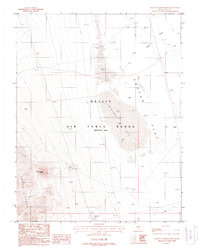
1987 Map of Roller Coaster Knob
USGS Topo · Published 1988About this map
Nellis Air Force Range (Restricted Area) defines this high desert territory in southern Nevada during the late Cold War era. The terrain is characterized by the prominent volcanic peak of Roller Coaster Knob and the northern extent of the Cactus Range. At the foot of these slopes lies Cactus Flat, dominated by the dry bed of Antelope Lake. The landscape is etched with various military test markers and radar installations including Radar TG 8, Target 1, and Pedro TG. A designated Radioactive Area near the center of the sheet reflects the specialized use of the range during this period. Navigation is limited to a network of 4WD trails and the isolated Mellan Airstrip in the east, while Breen Creek provides a singular ephemeral drainage in the northeast corner.
Find a feature on this map
19 named features on this map. Tap any name to fly to it.
Don’t see what you’re looking for? This feature index may not catch every label — zoom into the map to look around manually.
Map Details
Editions of this 1987 Roller Coaster Knob Map
This is the sole edition of this map. No revisions or reprints were ever made.
Other maps of this area

1908 · Kawich
USGS Topo · 1:250,000

1942 · Cactus Range
USGS Topo · 1:125,000

1952 · Stinking Spring
USGS Topo · 1:62,500

1952 · Mellan
USGS Topo · 1:62,500

1952 · Cactus Spring
USGS Topo · 1:62,500

1952 · Cactus Peak
USGS Topo · 1:62,500

1954 · Goldfield
USGS Topo · 1:250,000

1955 · Goldfield
USGS Topo · 1:250,000

1958 · Goldfield
USGS Topo · 1:250,000

1962 · Goldfield
USGS Topo · 1:250,000