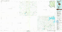
1985 Map of Roma-Los Saenz
USGS Topo · Published 1993About this map
Roma-Los Saenz serves as a primary international gateway along the Rio Grande in this mid-1980s look at the borderlands of south Starr Co, Texas, and northern Mexico. The landscape is defined by the winding river corridor and a network of arroyos, including Arroyo Los Olmos and Arroyo Roma, which carve through the Quiroga Hills. On the Mexican side, the massive Presa Marte R. Gomez reservoir dominates the southeast, fed by the Rio San Juan. This map provides a rare contiguous view of cross-border settlements, linking Texas communities like Fronton and Santa Margarita with the interior Mexican towns of Agualeguas and Los Aldamas. The presence of the Estación Aldama rail stop and the official Port of Entry highlights the long-standing transport and commerce ties between the two nations.
Find a feature on this map
32 named features on this map. Tap any name to fly to it.
Don’t see what you’re looking for? This feature index may not catch every label — zoom into the map to look around manually.
Map Details
Editions of this 1985 Roma-Los Saenz Map
This is the sole edition of this map. No revisions or reprints were ever made.
Other maps of this area

1938 · Falcon
USGS Topo · 1:62,500

1938 · El Sauz
USGS Topo · 1:62,500

1949 · Mc Allen
USGS Topo · 1:250,000

1954 · McAllen
USGS Topo · 1:250,000

1956 · Escobares
USGS Topo · 1:62,500

1956 · Roma
USGS Topo · 1:62,500

1957 · Mc Allen
USGS Topo · 1:250,000

1962 · McAllen
USGS Topo · 1:250,000

1965 · Los Garzas
USGS Topo · 1:24,000

1965 · Salineno
USGS Topo · 1:24,000