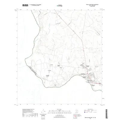
2019 Map of Roma-Los Saenz West
USGS Topo · Published 2019About this map
The Rio Grande serves as both a literal and political boundary in this 2019 survey of the South Texas borderlands, where the international line separates the United States of America and Estados Unidos Mexicanos. The landscape is defined by the tight clustering of residential developments near the river, including Roma-Los Saenz and various colonias such as Evergreen, Campobello, and De La Cruz Colonia. These settlements are interspersed with seasonal drainage features like Arroyo la Minita and Ramirez Creek that cut through the arid terrain toward the river valley.
Find a feature on this map
58 named features on this map. Tap any name to fly to it.
Don’t see what you’re looking for? This feature index may not catch every label — zoom into the map to look around manually.
Map Details
Editions of this 2019 Roma-Los Saenz West Map
This is the sole edition of this map. No revisions or reprints were ever made.
Other maps of this area

1938 · Falcon
USGS Topo · 1:62,500

1938 · El Sauz
USGS Topo · 1:62,500

1949 · Mc Allen
USGS Topo · 1:250,000

1954 · McAllen
USGS Topo · 1:250,000

1956 · Escobares
USGS Topo · 1:62,500

1956 · Roma
USGS Topo · 1:62,500

1957 · Mc Allen
USGS Topo · 1:250,000

1962 · McAllen
USGS Topo · 1:250,000

1965 · Los Garzas
USGS Topo · 1:24,000

1965 · Salineno
USGS Topo · 1:24,000