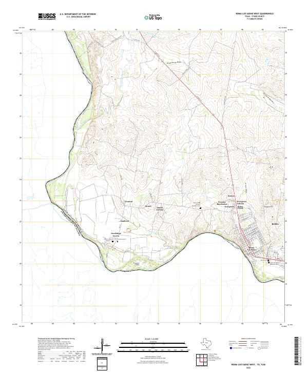
2022 Map of Roma-Los Saenz West
USGS Topo · Published 2022About this map
The Rio Grande defines the international boundary in this 2022 survey, anchoring a landscape of established settlements and expanding colonias in Starr County. The interconnected communities of Roma, Roma- Los Saenz, and Evergreen showcase a dense street grid organized around thoroughfares like N Grant St and Dr Mario E Ramirez Ave. These residential areas contrast with the surrounding brushland, which is dissected by numerous drainage channels including Arroyo de los Mudos, Arroyo la Mimita, and Ramirez Cr. Local genealogy is well-documented through several burial sites, such as Fronton Cem Number 1, Fronton Cem 2, and the Starr County Precinct Number 2 Cem. Further inland, family names and local geography appear in features like Gongora Hill and the settlement of Guadalupe Guerra, while Fronton Island remains a distinct landmark within the river's course.
Find a feature on this map
61 named features on this map. Tap any name to fly to it.
Don’t see what you’re looking for? This feature index may not catch every label — zoom into the map to look around manually.
Map Details
Editions of this 2022 Roma-Los Saenz West Map
This is the sole edition of this map. No revisions or reprints were ever made.
Other maps of this area

1938 · Falcon
USGS Topo · 1:62,500

1938 · El Sauz
USGS Topo · 1:62,500

1949 · Mc Allen
USGS Topo · 1:250,000

1954 · McAllen
USGS Topo · 1:250,000

1956 · Escobares
USGS Topo · 1:62,500

1956 · Roma
USGS Topo · 1:62,500

1957 · Mc Allen
USGS Topo · 1:250,000

1962 · McAllen
USGS Topo · 1:250,000

1965 · Los Garzas
USGS Topo · 1:24,000

1965 · Salineno
USGS Topo · 1:24,000
Featured Places
- Roma, TX
- Ramos Addition Number 1 Colonia, TX
- Fronton Ranchettes Colonia, TX
- Guadalupe Guerra Colonia, TX