
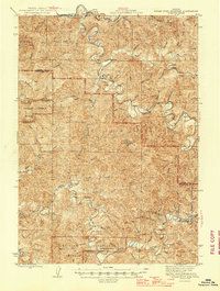
1945 Map of Roman Nose Mtn
USGS Topo · Published 1945About this map
The Siuslaw River and Smith River systems dominate this mid-century view of the Oregon Coast Range, where the terrain is marked by steep ridges and winding watercourses. Settlement is sparse, clustered primarily around small clearings and infrastructure such as the Alma Sch and the Southern Pacific rail line that skirts the northern edge of the map near Linslaw and Austa. For genealogists and local historians, the map preserves the locations of legacy homesteads like Luce Place, Hess Ranch, and Damewoods Place, which speak to the area's history of isolated rural habitation.
Find a feature on this map
52 named features on this map. Tap any name to fly to it.
Don’t see what you’re looking for? This feature index may not catch every label — zoom into the map to look around manually.
Map Details
Editions of this 1945 Roman Nose Mtn Map
2 editions found
Other maps of this area

1909 · Elmira
USGS Topo · 1:62,500

1918 · Mapleton
USGS Topo · 1:48,000

1919 · Earl
USGS Topo · 1:48,000

1922 · Elmira
USGS Topo · 1:62,500

1940 · Mapleton
USGS Topo · 1:62,500

1941 · Blachly
USGS Topo · 1:62,500

1942 · Elmira
USGS Topo · 1:62,500

1942 · Blachly
USGS Topo · 1:62,500

1942 · Crow
USGS Topo · 1:62,500

1942 · Roman Nose Mtn
USGS Topo · 1:62,500