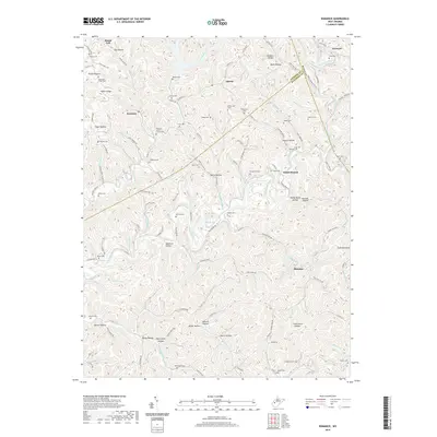
2019 Map of Romance
USGS Topo · Published 2019About this map
Advent, Romance, and Island Branch anchor this 2019 survey of the dissected plateaus where Jackson, Roane, and Kanawha Counties meet. The landscape is defined by the winding course of the Pocatalico River and its numerous tributaries, including Goose Creek and Grapevine Cr. The settlement pattern follows the narrow valley floors and ridgelines, with local life centered on family landmarks like Hammack Fisher Cem and Amos Haynes Cem. For genealogists and local historians, the sheer density of small burial grounds—such as Fields Cem, Vickers Cem, and the Pleasant Grove Church Cem—indicates a deeply rooted community where family lineage is etched into the topography. The naming of hollows and ridges, from Faber Hollow to Fisher Ridge, reflects a long history of local land use and geographic orientation within this complex Appalachian terrain.
Find a feature on this map
135 named features on this map. Tap any name to fly to it.
Don’t see what you’re looking for? This feature index may not catch every label — zoom into the map to look around manually.
Map Details
Editions of this 2019 Romance Map
This is the sole edition of this map. No revisions or reprints were ever made.
Other maps of this area

1897 · Kanawha Falls
USGS Topo · 1:125,000

1899 · Charleston
USGS Topo · 1:125,000

1900 · Kanawha Falls
USGS Topo · 1:125,000

1901 · Kanawha Falls
USGS Topo · 1:125,000

1906 · Kenna
USGS Topo · 1:62,500

1906 · Walton
USGS Topo · 1:62,500

1907 · Kenna
USGS Topo · 1:62,500

1907 · Walton
USGS Topo · 1:62,500

1907 · Clendenin
USGS Topo · 1:62,500

1909 · Charleston
USGS Topo · 1:62,500