
1958 Map of Rome
USGS Topo · Published 1966About this map
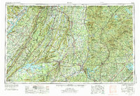
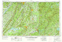
Rome serves as the central hub of this Northwest Georgia survey, situated at the confluence of the Oostanaula River and Etowah River where they form the Coosa River. The landscape is dominated by the dramatic linear ridges of the Valley and Ridge province, including Lookout Mountain, Shinbone Ridge, and Taylor Ridge, which define the region's transport corridors. To the north, Chattanooga and the historic grounds of Chickamauga and Chattanooga National Military Park sit near the Tennessee border, while the industrial and rail growth of the mid-20th century is evident in the network of the Southern Ry and Louisville & Nashville RR. The eastern portion transitions into the higher elevations of the Blue Ridge mountains, much of which is protected within the Chattahoochee National Forest. This era shows the developed recreation and power landscape of the Weiss Reservoir and Lake Sidney Lanier flanking the mountainous interior.
Find a feature on this map
64 named features on this map. Tap any name to fly to it.
Don’t see what you’re looking for? This feature index may not catch every label — zoom into the map to look around manually.
Map Details
Editions of this 1958 Rome Map
3 editions found
Other maps of this area

1885 · Gadsden
USGS Topo · 1:125,000

1886 · Dalton
USGS Topo · 1:125,000

1886 · Cleveland
USGS Topo · 1:125,000

1886 · Ringgold
USGS Topo · 1:125,000

1886 · Rome
USGS Topo · 1:125,000

1886 · Stevenson
USGS Topo · 1:125,000

1886 · Dahlonega
USGS Topo · 1:125,000

1888 · Gadsden
USGS Topo · 1:125,000

1888 · Ellijay
USGS Topo · 1:125,000

1888 · Chattanooga
USGS Topo · 1:125,000