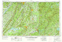
1958 Map of Rome
USGS Topo · Published 1974About this map
The Coosa River, Etowah River, and Oostanaula River converge at Rome, Georgia, forming a central hydrologic hub for a region defined by the dramatic north-south ridges of the Blue Ridge and Lookout Mountain. In the mid-20th century, this landscape was transitioning through infrastructure projects like the creation of Lake Sidney Lanier and Weiss Lake, which altered traditional drainage and land use patterns. Military history remains a prominent feature of the terrain, specifically at the Chickamauga and Chattanooga National Military Park and Fort Oglethorpe near the Tennessee border.
Find a feature on this map
50 named features on this map. Tap any name to fly to it.
Don’t see what you’re looking for? This feature index may not catch every label — zoom into the map to look around manually.
Map Details
Editions of this 1958 Rome Map
3 editions found

Other maps of this area

1885 · Gadsden
USGS Topo · 1:125,000

1886 · Dalton
USGS Topo · 1:125,000

1886 · Cleveland
USGS Topo · 1:125,000

1886 · Ringgold
USGS Topo · 1:125,000

1886 · Rome
USGS Topo · 1:125,000

1886 · Stevenson
USGS Topo · 1:125,000

1886 · Dahlonega
USGS Topo · 1:125,000

1888 · Gadsden
USGS Topo · 1:125,000

1888 · Ellijay
USGS Topo · 1:125,000

1888 · Chattanooga
USGS Topo · 1:125,000