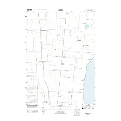
2013 Map of Romulus
USGS Topo · Published 2013About this map
The eastern shore of Cayuga Lake defines this portion of the Finger Lakes region, where agricultural heritage and military history converge. The vast footprint of the Seneca Army Depot occupies the western edge, providing a sharp contrast to the surrounding patchwork of family farms and established wineries like Swedish Hill Vineyard. The landscape is dotted with ancestral burial grounds, including Red Jacket Cem near the lake and Mt Green Cem on the outskirts of Romulus. Small rural clusters such as Fayette, Canoga Springs, and McDuffie Town are connected by a network of historic roads, including Yellow Tavern Rd and Leader Rd. Local aviation is represented by Airtrek Airport, while numerous seasonal creeks like Sucker Brook and Burroughs Cr drain toward the lake basin, illustrating the well-watered geography of Seneca County.
Find a feature on this map
90 named features on this map. Tap any name to fly to it.
Don’t see what you’re looking for? This feature index may not catch every label — zoom into the map to look around manually.
Map Details
Editions of this 2013 Romulus Map
This is the sole edition of this map. No revisions or reprints were ever made.
Other maps of this area

1899 · Auburn
USGS Topo · 1:62,500

1902 · Geneva
USGS Topo · 1:62,500

1902 · Genoa
USGS Topo · 1:62,500

1902 · Ovid
USGS Topo · 1:62,500

1902 · Auburn
USGS Topo · 1:62,500

1942 · Ovid
USGS Topo · 1:31,680

1942 · Sheldrake
USGS Topo · 1:24,000

1943 · Dresden
USGS Topo · 1:31,680

1943 · Geneva North
USGS Topo · 1:31,680

1943 · Geneva South
USGS Topo · 1:31,680