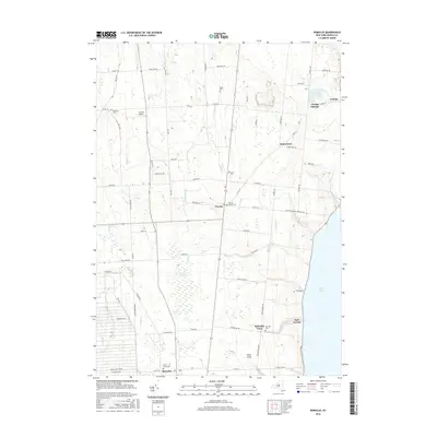
2016 Map of Romulus
USGS Topo · Published 2016About this map
Cayuga Lake forms the eastern boundary of this Seneca County landscape, where the shoreline hamlets of Canoga and East Varick overlook the water. Moving inland, the terrain is defined by a dense grid of rural roads and agricultural plots, punctuated by small settlements like Fayette and Romulus. A significant portion of the southwestern quadrant is occupied by the Seneca Army Depot, showing a stark contrast in land use compared to the surrounding family farms and homesteads. Local history is preserved in numerous burial grounds, including Mount Green Cem and Jerusalem Cem, while natural drainage features like Sucker Brook and the Cranberry Marsh weave through the central plains. The presence of Airtrek Airport and the distinct footprint of McDuffie Town illustrate the ongoing evolution of this Finger Lakes region as it appeared in 2016.
Find a feature on this map
75 named features on this map. Tap any name to fly to it.
Don’t see what you’re looking for? This feature index may not catch every label — zoom into the map to look around manually.
Map Details
Editions of this 2016 Romulus Map
This is the sole edition of this map. No revisions or reprints were ever made.
Other maps of this area

1899 · Auburn
USGS Topo · 1:62,500

1902 · Geneva
USGS Topo · 1:62,500

1902 · Genoa
USGS Topo · 1:62,500

1902 · Ovid
USGS Topo · 1:62,500

1902 · Auburn
USGS Topo · 1:62,500

1942 · Ovid
USGS Topo · 1:31,680

1942 · Sheldrake
USGS Topo · 1:24,000

1943 · Dresden
USGS Topo · 1:31,680

1943 · Geneva North
USGS Topo · 1:31,680

1943 · Geneva South
USGS Topo · 1:31,680