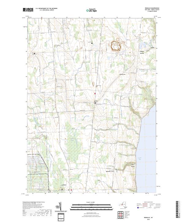
2023 Map of Romulus
USGS Topo · Published 2023About this map
Cayuga Lake forms the eastern boundary of this Seneca County landscape, where the agricultural uplands transition to the western shoreline. The massive footprint of the Seneca Army Depot dominates the southwestern portion of the map, illustrating the significant military presence that has shaped local land use for decades. This modern survey captures a network of small, established hamlets such as Fayette, Romulus, and Kuneytown connected by a grid of rural roads named for early families. The area is dotted with historical burial grounds, including Mount Green Cem, Oak Hill Cem, and the Jerusalem Cem, which provide essential points of reference for genealogists. Environmental features like the Cranberry Marsh and various watercourses including Sucker Brook and Kendig Creek define the drainage patterns flowing toward the lake.
Find a feature on this map
75 named features on this map. Tap any name to fly to it.
Don’t see what you’re looking for? This feature index may not catch every label — zoom into the map to look around manually.
Map Details
Editions of this 2023 Romulus Map
This is the sole edition of this map. No revisions or reprints were ever made.
Other maps of this area

1899 · Auburn
USGS Topo · 1:62,500

1902 · Geneva
USGS Topo · 1:62,500

1902 · Genoa
USGS Topo · 1:62,500

1902 · Ovid
USGS Topo · 1:62,500

1902 · Auburn
USGS Topo · 1:62,500

1942 · Ovid
USGS Topo · 1:31,680

1942 · Sheldrake
USGS Topo · 1:24,000

1943 · Dresden
USGS Topo · 1:31,680

1943 · Geneva North
USGS Topo · 1:31,680

1943 · Geneva South
USGS Topo · 1:31,680