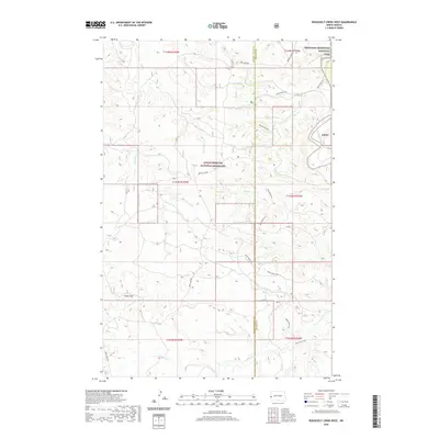
2020 Map of Roosevelt Creek West
USGS Topo · Published 2020About this map
The Little Missouri National Grassland dominates this landscape along the border of Golden Valley and Billings counties. The terrain is defined by the winding course of the Little Missouri River and a network of drainages including Roosevelt Cr, Bell Lake Cr, and Ellison Cr. Rising above the surrounding breaks, Cooks Peak serves as a prominent landmark in the southwestern portion of the quadrangle. The map highlights a significant section of the Theodore Roosevelt National Park in the northeast, where the badlands topography is most pronounced. This area is a critical corridor for outdoor recreation and conservation, featuring the long-distance Maah Daah Hey trail which meanders through the grasslands and park boundaries. Primitive travel routes like Belle Lake Rd and Beaver Creek Rd provide the primary access through this sparsely populated ranching and public land mosaic.
Find a feature on this map
19 named features on this map. Tap any name to fly to it.
Don’t see what you’re looking for? This feature index may not catch every label — zoom into the map to look around manually.
Map Details
Editions of this 2020 Roosevelt Creek West Map
This is the sole edition of this map. No revisions or reprints were ever made.
Other maps of this area

1953 · Watford City
USGS Topo · 1:250,000

1957 · Watford City
USGS Topo · 1:250,000

1967 · Watford City
USGS Topo · 1:250,000

1970 · Eagle Draw
USGS Topo · 1:24,000

1970 · Hanks Gully
USGS Topo · 1:24,000

1970 · Wannagan Creek East
USGS Topo · 1:24,000

1970 · Roosevelt Creek East
USGS Topo · 1:24,000

1974 · Trotters SE
USGS Topo · 1:24,000

1974 · West Twin Butte
USGS Topo · 1:24,000

1974 · Roosevelt Creek West
USGS Topo · 1:24,000