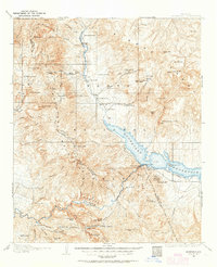
1907 Map of Roosevelt
USGS Topo · Published 1964About this map
The Roosevelt Dam anchors this early twentieth-century landscape, capturing a pivotal moment in the management of the Salt River. This survey, conducted between 1905 and 1907, documents the area just as the Roosevelt Reservoir was being formed, significantly altering the hydrology of the Tonto Creek and Salt River confluence. Away from the water, the map reveals a network of high-desert outposts and homesteads, including Howell's Ranch, Blanton's Ranch, and Schell's Station. The presence of Tonto National Monument and the various cattle ranches like Bouquet Ranch and Edwards Ranch illustrate the transition from ancient habitations to early Arizona territory agriculture. Topographical features such as Mt Ord, Four Peaks, and the Painted Cliffs provide clear landmarks for the many trails and early power lines that would soon connect these remote canyons to the growing infrastructure of Central Arizona.
Find a feature on this map
87 named features on this map. Tap any name to fly to it.
Don’t see what you’re looking for? This feature index may not catch every label — zoom into the map to look around manually.
Map Details
Editions of this 1907 Roosevelt Map
2 editions found

Other maps of this area

1886 · Holbrook
USGS Topo · 1:250,000

1887 · Verde
USGS Topo · 1:250,000

1892 · Verde
USGS Topo · 1:250,000

1893 · Holbrook
USGS Topo · 1:250,000

1900 · Florence
USGS Topo · 1:125,000

1901 · Globe
USGS Topo · 1:62,500

1902 · Globe
USGS Topo · 1:62,500

1902 · Florence
USGS Topo · 1:125,000

1904 · Desert Well
USGS Topo · 1:62,500

1904 · Ft. McDowell
USGS Topo · 1:62,500