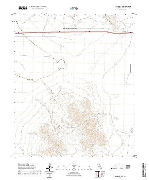
2021 Map of Roosevelt Mine
USGS Topo · Published 2021About this map
Mule Mountains dominate the southern portion of this Riverside County landscape, rising abruptly from the surrounding desert floor. The area is characterized by the broad Chuckwalla Valley and the expansive Palo Verde Mesa to the east, illustrating a classic basin-and-range topographic pattern. Human activity is largely concentrated along the northern corridor where infrastructure and early routes intersect the foothills of the McCoy Mountains.
Find a feature on this map
14 named features on this map. Tap any name to fly to it.
Don’t see what you’re looking for? This feature index may not catch every label — zoom into the map to look around manually.
Map Details
Editions of this 2021 Roosevelt Mine Map
This is the sole edition of this map. No revisions or reprints were ever made.
Other maps of this area

1942 · Blythe
USGS Topo · 1:250,000

1945 · Cibola
USGS Topo · 1:62,500

1951 · McCoy Wash
USGS Topo · 1:24,000

1951 · Cibola
USGS Topo · 1:62,500

1952 · Mc Coy Spring
USGS Topo · 1:62,500

1952 · Palo Verde
USGS Topo · 1:24,000

1952 · Ripley
USGS Topo · 1:24,000

1953 · Palo Verde Mountains
USGS Topo · 1:62,500

1954 · Salton Sea
USGS Topo · 1:250,000

1955 · Salton Sea
USGS Topo · 1:250,000