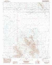
1983 Map of Roosevelt Mine
USGS Topo · Published 1983About this map
The Mule Mountains dominate the southern landscape of this 1983 survey, where extraction and infrastructure define the terrain. The central high ground is marked by the Roosevelt Mine, Mule Mine, and Hodge Mine, alongside a large Open Pit Mine further east. These mining operations are surrounded by a network of industrial conduits, including a Double Woodpole Power Line and 2 UG Gas Lines that cut across the northern flats of the Chuckwalla Valley.
Find a feature on this map
22 named features on this map. Tap any name to fly to it.
Don’t see what you’re looking for? This feature index may not catch every label — zoom into the map to look around manually.
Map Details
Editions of this 1983 Roosevelt Mine Map
This is the sole edition of this map. No revisions or reprints were ever made.
Other maps of this area

1942 · Blythe
USGS Topo · 1:250,000

1945 · Cibola
USGS Topo · 1:62,500

1951 · McCoy Wash
USGS Topo · 1:24,000

1951 · Cibola
USGS Topo · 1:62,500

1952 · Mc Coy Spring
USGS Topo · 1:62,500

1952 · Palo Verde
USGS Topo · 1:24,000

1952 · Ripley
USGS Topo · 1:24,000

1953 · Palo Verde Mountains
USGS Topo · 1:62,500

1954 · Salton Sea
USGS Topo · 1:250,000

1955 · Salton Sea
USGS Topo · 1:250,000