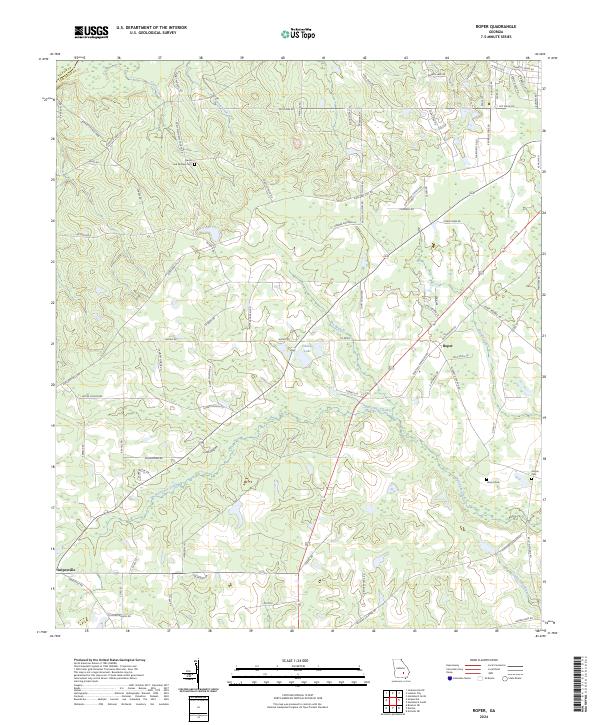
2024 Map of Roper
USGS Topo · Published 2024About this map
Snipesville and the crossroads at Roper define the settlement patterns of this Jeff Davis County landscape. The terrain is intricately carved by several waterways, including the broad reaches of Hurricane Creek and its tributaries like Old Field Branch and Fox Branch. Agriculture and timber interests are evident through a dense network of local roads such as Kight Sellers Cir, Ussery Rd, and Saint Matthews Church Rd, reflecting the modern rural infrastructure of south-central Georgia. For genealogists and local historians, the map identifies family-named sites and resting places, notably the Harris and McDew Cem and Hinson Cem. Evidence of past river crossings remains at Burketts Ferry Lndg on the edge of the Telfair Co line, while recreational or agricultural water management is seen at Okuinn Lake.
Find a feature on this map
85 named features on this map. Tap any name to fly to it.
Don’t see what you’re looking for? This feature index may not catch every label — zoom into the map to look around manually.
Map Details
Editions of this 2024 Roper Map
This is the sole edition of this map. No revisions or reprints were ever made.
Other maps of this area

1953 · Waycross
USGS Topo · 1:250,000

1958 · Waycross
USGS Topo · 1:250,000

1971 · Nicholls NE
USGS Topo · 1:24,000

1971 · Roper
USGS Topo · 1:24,000

1971 · Jacksonville NE
USGS Topo · 1:24,000

1971 · Snipesville
USGS Topo · 1:24,000
1971 · Hazlehurst North
USGS Topo · 1:24,000

1971 · Broxton NE
USGS Topo · 1:24,000

1971 · Hazlehurst South
USGS Topo · 1:24,000

1971 · Denton
USGS Topo · 1:24,000