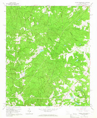
1964 Map of Ropers Crossroads
USGS Topo · Published 1966About this map
Ropers Crossroads anchors this mid-1960s survey of the wooded boundary between Edgefield and Aiken counties. The landscape is defined by the headwaters of numerous creek systems, including Horn Creek, Cheves Creek, and Tobler Creek, which carve through the Sumter National Forest. The map documents a deeply rooted rural community evidenced by its numerous country churches and social landmarks, such as Science Hill Ch, Jeter Ch, and the Rock Hill Society Hall.
Find a feature on this map
40 named features on this map. Tap any name to fly to it.
Don’t see what you’re looking for? This feature index may not catch every label — zoom into the map to look around manually.
Map Details
Editions of this 1964 Ropers Crossroads Map
2 editions found
Other maps of this area

1892 · Mc Cormick
USGS Topo · 1:125,000

1912 · Mc Cormick
USGS Topo · 1:125,000

1920 · Clarks Hill
USGS Topo · 1:48,000

1921 · Clarks Hill
USGS Topo · 1:62,500

1923 · Warrenville
USGS Topo · 1:48,000

1928 · Warrenville
USGS Topo · 1:62,500

1941 · Clarks Hill
USGS Topo · 1:62,500

1942 · Clarks Hill
USGS Topo · 1:62,500

1943 · Warrenville
USGS Topo · 1:62,500

1953 · Athens
USGS Topo · 1:250,000