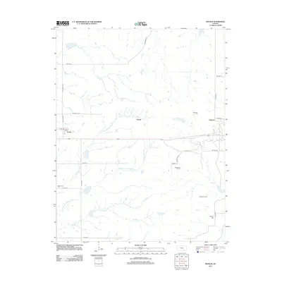
2012 Map of Rosalia
USGS Topo · Published 2012About this map
Rosalia sits at the heart of this Butler County landscape, serving as a hub for the surrounding ranching and petroleum country in the early 21st century. The map reveals a land defined by the drainages of the Walnut River system, including the N Br Little Walnut River and Middle Br Little Walnut River, which carve through the plains. The region’s economic history is etched into the terrain through various petroleum developments such as the Jackson Oil Field and Blankenship Oil Field. For local historians and genealogists, the presence of Blankenship Cem and the small settlements of Summit and Sallyards offer critical points for tracing family ties to this corner of Kansas. The infrastructure is characterized by a precise grid of township roads, including NE Flinthills St and Cattle Pen Rd, which connect remote homesteads to the central community and the higher ground of Windy Hill.
Find a feature on this map
35 named features on this map. Tap any name to fly to it.
Don’t see what you’re looking for? This feature index may not catch every label — zoom into the map to look around manually.
Map Details
Editions of this 2012 Rosalia Map
This is the sole edition of this map. No revisions or reprints were ever made.
Other maps of this area

1885 · Eureka
USGS Topo · 1:125,000

1888 · Eureka
USGS Topo · 1:125,000

1888 · Eldorado
USGS Topo · 1:125,000

1894 · Eureka
USGS Topo · 1:125,000

1955 · Wichita
USGS Topo · 1:250,000

1958 · Wichita
USGS Topo · 1:250,000

1961 · Pontiac
USGS Topo · 1:24,000

1961 · Rosalia NE
USGS Topo · 1:24,000

1961 · Rosalia
USGS Topo · 1:24,000
1961 · Rosalia NW
USGS Topo · 1:24,000