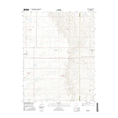
2015 Map of Rosalia
USGS Topo · Published 2015About this map
Rosalia sits at the intersection of SE 5th Ter and SE Rosalia Rd, serving as a primary point of settlement in this Kansas prairie landscape. The terrain is defined by the branching headwaters of the N Br Little Walnut River and the Middle Br Little Walnut River, which carve subtle valleys across the Flint Hills region. The eastern edge of the area is marked by the border between Butler and Greenwood counties, where the high ground of Windy Hill rises near the drainage of Spring Creek.
Find a feature on this map
38 named features on this map. Tap any name to fly to it.
Don’t see what you’re looking for? This feature index may not catch every label — zoom into the map to look around manually.
Map Details
Editions of this 2015 Rosalia Map
This is the sole edition of this map. No revisions or reprints were ever made.
Other maps of this area

1885 · Eureka
USGS Topo · 1:125,000

1888 · Eureka
USGS Topo · 1:125,000

1888 · Eldorado
USGS Topo · 1:125,000

1894 · Eureka
USGS Topo · 1:125,000

1955 · Wichita
USGS Topo · 1:250,000

1958 · Wichita
USGS Topo · 1:250,000

1961 · Pontiac
USGS Topo · 1:24,000

1961 · Rosalia NE
USGS Topo · 1:24,000

1961 · Rosalia
USGS Topo · 1:24,000
1961 · Rosalia NW
USGS Topo · 1:24,000