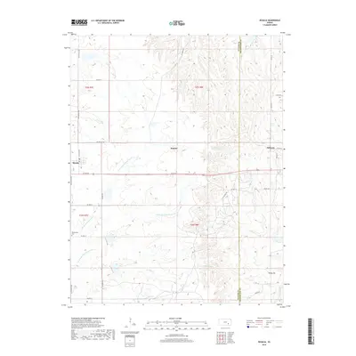
2018 Map of Rosalia
USGS Topo · Published 2018About this map
Rosalia and the surrounding prairie of Butler County are defined by a complex network of waterways that feed the Walnut River basin. The village itself sits at the western edge of the quadrangle, while the smaller locales of Summit and Sallyards are positioned along the county line and the drainage of Silver Cr. This landscape is deeply etched by the N Br Little Walnut River and the Middle Br Little Walnut River, which carve through the Flint Hills terrain.
Find a feature on this map
37 named features on this map. Tap any name to fly to it.
Don’t see what you’re looking for? This feature index may not catch every label — zoom into the map to look around manually.
Map Details
Editions of this 2018 Rosalia Map
This is the sole edition of this map. No revisions or reprints were ever made.
Other maps of this area

1885 · Eureka
USGS Topo · 1:125,000

1888 · Eureka
USGS Topo · 1:125,000

1888 · Eldorado
USGS Topo · 1:125,000

1894 · Eureka
USGS Topo · 1:125,000

1955 · Wichita
USGS Topo · 1:250,000

1958 · Wichita
USGS Topo · 1:250,000

1961 · Pontiac
USGS Topo · 1:24,000

1961 · Rosalia NE
USGS Topo · 1:24,000

1961 · Rosalia
USGS Topo · 1:24,000
1961 · Rosalia NW
USGS Topo · 1:24,000