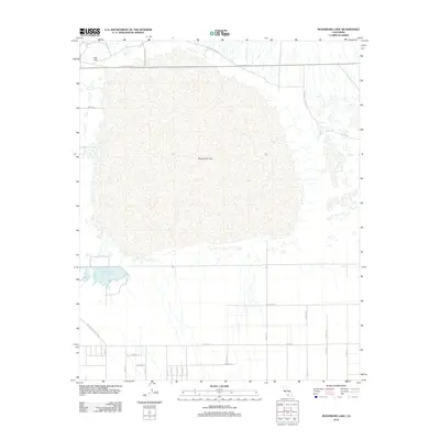
2012 Map of Rosamond Lake
USGS Topo · Published 2012About this map
Rosamond Lake dominates this high-desert landscape in Kern County, forming a vast dry expanse that has long served as a natural landing site. Part of the Edwards Air Force Sta boundary, the lakebed is surrounded by a grid of rural desert roads and sensitive water features like the Piute Ponds to the southwest. This 2012 survey illustrates the intersection of military aeronautical infrastructure and the natural topography of the Antelope Valley. To the northwest, Red Hill provides a distinct vertical landmark against the flat basin, while arterial routes like W Rosamond Blvd and Willow Springs Rd connect this remote sector to the growing communities beyond the map's edges. The layout of the southern half of the sheet shows a transitioning landscape, with numerous named avenues and streets such as Marie Ave plotted across the arid terrain.
Find a feature on this map
27 named features on this map. Tap any name to fly to it.
Don’t see what you’re looking for? This feature index may not catch every label — zoom into the map to look around manually.
Map Details
Editions of this 2012 Rosamond Lake Map
This is the sole edition of this map. No revisions or reprints were ever made.
Other maps of this area

1915 · Elizabeth Lake
USGS Topo · 1:125,000

1917 · Elizabeth Lake
USGS Topo · 1:125,000

1930 · Oban
USGS Topo · 1:24,000

1930 · Roosevelt School
USGS Topo · 1:24,000

1930 · Casa Desierta
USGS Topo · 1:24,000

1933 · Casa Desierta
USGS Topo · 1:24,000

1933 · Roosevelt School
USGS Topo · 1:24,000

1933 · Oban
USGS Topo · 1:24,000

1937 · Rogers Lake
USGS Topo · 1:48,000

1942 · Rogers Lake
USGS Topo · 1:62,500