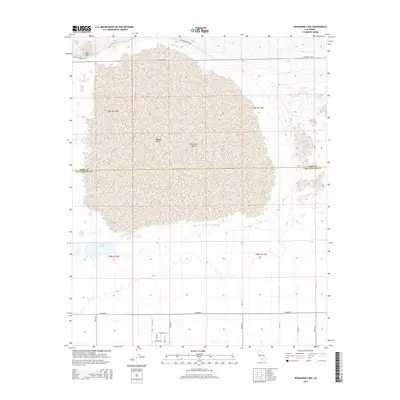
2015 Map of Rosamond Lake
USGS Topo · Published 2015About this map
Rosamond Lake dominates this portion of the Mojave Desert, serving as a massive dry lakebed that spans the border between Kern and Los Angeles Counties. The terrain is characterized by the flat expanse of the playa, punctuated in the northwest by Red Hill. Water features are scarce in this arid environment, though the Piute Ponds provide a distinct wetland area to the southwest. The mapping reflects a structured grid of local roads and section lines, including E Avenue E and Willow Springs Rd, which frame the undeveloped desert floor. This 2015 data illustrates the geographic divide between the Antelope Valley and the expansive lakebed used for aerospace and military activities in the surrounding region.
Find a feature on this map
23 named features on this map. Tap any name to fly to it.
Don’t see what you’re looking for? This feature index may not catch every label — zoom into the map to look around manually.
Map Details
Editions of this 2015 Rosamond Lake Map
This is the sole edition of this map. No revisions or reprints were ever made.
Other maps of this area

1915 · Elizabeth Lake
USGS Topo · 1:125,000

1917 · Elizabeth Lake
USGS Topo · 1:125,000

1930 · Oban
USGS Topo · 1:24,000

1930 · Roosevelt School
USGS Topo · 1:24,000

1930 · Casa Desierta
USGS Topo · 1:24,000

1933 · Casa Desierta
USGS Topo · 1:24,000

1933 · Roosevelt School
USGS Topo · 1:24,000

1933 · Oban
USGS Topo · 1:24,000

1937 · Rogers Lake
USGS Topo · 1:48,000

1942 · Rogers Lake
USGS Topo · 1:62,500