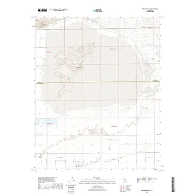
2018 Map of Rosamond Lake
USGS Topo · Published 2018About this map
Rosamond Lake dominates this section of the western Mojave Desert, marking a stark geographical divide where the flat expanse of the dry lake bed meets the rising terrain of Red Hill. The landscape is defined by its transition across the Kern Co Los Angeles Co boundary, where a rigid grid of desert roads like Challenger Way and W Rosamond Blvd segments the arid terrain. To the south, the presence of the Piute Ponds indicates a localized water system that stands in contrast to the surrounding desert environment. This survey captures a moment in the region's modern layout, showing the precise intersection of administrative county lines with the natural contours of the desert basin and its seasonal water features.
Find a feature on this map
35 named features on this map. Tap any name to fly to it.
Don’t see what you’re looking for? This feature index may not catch every label — zoom into the map to look around manually.
Map Details
Editions of this 2018 Rosamond Lake Map
This is the sole edition of this map. No revisions or reprints were ever made.
Other maps of this area

1915 · Elizabeth Lake
USGS Topo · 1:125,000

1917 · Elizabeth Lake
USGS Topo · 1:125,000

1930 · Oban
USGS Topo · 1:24,000

1930 · Roosevelt School
USGS Topo · 1:24,000

1930 · Casa Desierta
USGS Topo · 1:24,000

1933 · Casa Desierta
USGS Topo · 1:24,000

1933 · Roosevelt School
USGS Topo · 1:24,000

1933 · Oban
USGS Topo · 1:24,000

1937 · Rogers Lake
USGS Topo · 1:48,000

1942 · Rogers Lake
USGS Topo · 1:62,500