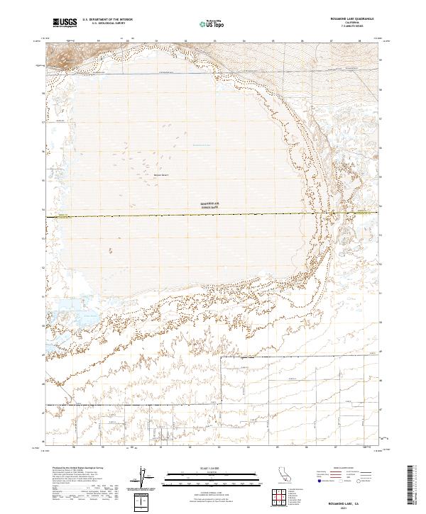
2021 Map of Rosamond Lake
USGS Topo · Published 2021About this map
Rosamond Lake dominates this portion of the Mojave Desert, marking a stark dry lake bed landscape straddling the line between Kern and Los Angeles Counties. The survey reveals a rigid grid of planned infrastructure extending into the arid basin, with thoroughfares such as Challenger Way and W Rosamond Blvd providing access to the expansive flatlands. To the northwest, the elevation rises toward Red Hill and the winding path of Willow Springs Rd. In the southwest corner, the Piute Ponds indicate a pocket of surface water and managed wetlands, contrasting sharply with the surrounding desert floor. This 2021 update documents the intersection of aerospace-adjacent naming conventions and traditional township and range divisions, capturing the modern footprint of the Antelope Valley's high-desert geography.
Find a feature on this map
37 named features on this map. Tap any name to fly to it.
Don’t see what you’re looking for? This feature index may not catch every label — zoom into the map to look around manually.
Map Details
Editions of this 2021 Rosamond Lake Map
This is the sole edition of this map. No revisions or reprints were ever made.
Other maps of this area

1915 · Elizabeth Lake
USGS Topo · 1:125,000

1917 · Elizabeth Lake
USGS Topo · 1:125,000

1930 · Oban
USGS Topo · 1:24,000

1930 · Roosevelt School
USGS Topo · 1:24,000

1930 · Casa Desierta
USGS Topo · 1:24,000

1933 · Casa Desierta
USGS Topo · 1:24,000

1933 · Roosevelt School
USGS Topo · 1:24,000

1933 · Oban
USGS Topo · 1:24,000

1937 · Rogers Lake
USGS Topo · 1:48,000

1942 · Rogers Lake
USGS Topo · 1:62,500