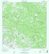
1964 Map of Rosario
USGS Topo · Published 1968About this map
The agricultural heartland of western Puerto Rico is defined by its numerous historic estates and haciendas, such as Hacienda Constanza and Hacienda Juanita. This mid-century landscape is marked by the transition from traditional landholdings to a modernizing infrastructure, evidenced by the Represa de Mayagüez and Hospital de Tuberculosis. The central settlement of Rosario serves as a local hub near the Rio Rosario, while the Antillian College and Hospital Bella Vista signal the growth of institutional centers in the Mayaguez Arriba district. Genealogists can trace family footprints across several barrios, including Rosario Bajo, Duey Alto, and Hoconuco Alto, where rural schools like the Escuela José C Barbosa and the Escuela Juan María Palmer anchored the communities. The terrain rises toward landmarks like Cerro de la Candelaria, overlooking a network of quebradas and rivers that fueled the region's long history of sugar and coffee production.
Find a feature on this map
106 named features on this map. Tap any name to fly to it.
Don’t see what you’re looking for? This feature index may not catch every label — zoom into the map to look around manually.
Map Details
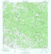
Editions of this 1964 Rosario Map
2 editions found
Other maps of this area

1935 · Puerto Real
USGS Topo · 1:25,000

1937 · San German
USGS Topo · 1:25,000

1937 · Sabana Grande
USGS Topo · 1:25,000

1937 · Puerto Real
USGS Topo · 1:25,000

1938 · Alto Sano
USGS Topo · 1:20,000

1938 · San Sebastian
USGS Topo · 1:20,000

1939 · Mayaguez
USGS Topo · 1:30,000

1941 · Rincon
USGS Topo · 1:30,000

1941 · San German
USGS Topo · 1:30,000

1941 · Puerto Real
USGS Topo · 1:30,000
Featured Places
- Sector Los Martinel, Las Marías
- Urb. Mansiones La Monserrate, Hormigueros
- Sector Coquí, Mayagüez
- Sector Punto Cubano, Hormigueros
- Sector Leclerc, Mayagüez