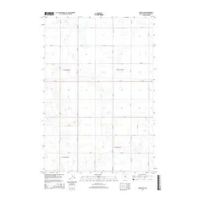
2015 Map of Roscoe NW
USGS Topo · Published 2015About this map
Glacial potholes and prairie wetlands define the topography of this Edmunds County landscape, as mapped during the early 21st century. The section lines of the Public Land Survey System dictate the movement of local traffic, with unpaved routes like 336th Ave and 338th Ave crossing an expansive network of East River prairie basins. While most thoroughfares follow the rigid 1-mile grid system, including 134th St and 131st St, the southern portion of the quadrangle shows minor deviations with named local connectors such as Valley Rd and Glover Rd. This pattern of township and range divisions, specifically within t123n r72w and t123n r71w, illustrates the enduring influence of the 19th-century homesteading layout on modern South Dakota agricultural land use.
Find a feature on this map
20 named features on this map. Tap any name to fly to it.
Don’t see what you’re looking for? This feature index may not catch every label — zoom into the map to look around manually.
Map Details
Editions of this 2015 Roscoe NW Map
This is the sole edition of this map. No revisions or reprints were ever made.
Other maps of this area

1954 · Aberdeen
USGS Topo · 1:250,000

1956 · Aberdeen
USGS Topo · 1:250,000

1974 · Gretna
USGS Topo · 1:24,000

1974 · Roscoe
USGS Topo · 1:24,000

1974 · Bowdle SE
USGS Topo · 1:24,000

1974 · Roscoe SW
USGS Topo · 1:24,000

1978 · Loyalton
USGS Topo · 1:24,000

1978 · Hillsview SE
USGS Topo · 1:24,000

1978 · Roscoe NW
USGS Topo · 1:24,000

1978 · Hosmer SE
USGS Topo · 1:24,000