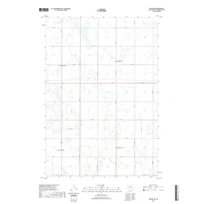
2017 Map of Roscoe NW
USGS Topo · Published 2017About this map
Glacial depressions and prairie wetlands define this corner of Edmunds County, where the township lines of t123n r71w and t122n r72w meet. The landscape is structured by a rigid section-line road grid, including long stretches of 134th St and 336th Ave that cross the open terrain. This 2017 survey reveals the persistent agricultural geometry of the northern Great Plains, with large parcels of land divided by secondary routes such as Glover Rd and Valley Rd. Small, scattered water bodies are prevalent throughout the region, reflecting the local hydrology and drainage patterns of the South Dakota prairie. For those studying the evolution of rural infrastructure, the map documents the network of county roads like Co Rd 8 and Co Rd 4a that provide essential connectivity between the isolated farmsteads and larger regional centers.
Find a feature on this map
23 named features on this map. Tap any name to fly to it.
Don’t see what you’re looking for? This feature index may not catch every label — zoom into the map to look around manually.
Map Details
Editions of this 2017 Roscoe NW Map
This is the sole edition of this map. No revisions or reprints were ever made.
Other maps of this area

1954 · Aberdeen
USGS Topo · 1:250,000

1956 · Aberdeen
USGS Topo · 1:250,000

1974 · Gretna
USGS Topo · 1:24,000

1974 · Roscoe
USGS Topo · 1:24,000

1974 · Bowdle SE
USGS Topo · 1:24,000

1974 · Roscoe SW
USGS Topo · 1:24,000

1978 · Loyalton
USGS Topo · 1:24,000

1978 · Hillsview SE
USGS Topo · 1:24,000

1978 · Roscoe NW
USGS Topo · 1:24,000

1978 · Hosmer SE
USGS Topo · 1:24,000