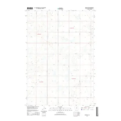
2015 Map of Roscoe SW
USGS Topo · Published 2015About this map
Glacial depressions and prairie wetlands define the landscape of this portion of Edmunds County in the mid-2010s. The area is organized by the Public Land Survey System, with the map centered on the junction of four townships: T122n R71w, t122n r72w, t121n r71w, and T121n R72w. This rural South Dakota expanse is characterized by a sparse, geometric grid of gravel roads, such as 140th St and 147th St, which serve as the primary conduits for the agricultural activities of the region. The numerous small, unnamed water bodies scattered throughout the sections illustrate the poorly drained nature of this upland terrain, typical of the Missouri Coteau. Significant north-south corridors like 337th Ave and 340th Ave delineate the section lines, providing a clear view of the rural homestead and field patterns that have persisted in this part of the state for decades.
Find a feature on this map
18 named features on this map. Tap any name to fly to it.
Don’t see what you’re looking for? This feature index may not catch every label — zoom into the map to look around manually.
Map Details
Editions of this 2015 Roscoe SW Map
This is the sole edition of this map. No revisions or reprints were ever made.
Other maps of this area

1950 · Onaka
USGS Topo · 1:24,000

1951 · Clark Lake
USGS Topo · 1:24,000

1952 · Onaka
USGS Topo · 1:24,000

1954 · Aberdeen
USGS Topo · 1:250,000

1956 · Aberdeen
USGS Topo · 1:250,000

1965 · Onaka
USGS Topo · 1:24,000

1974 · Gretna
USGS Topo · 1:24,000

1974 · Roscoe
USGS Topo · 1:24,000

1974 · Bowdle SE
USGS Topo · 1:24,000

1974 · Roscoe SW
USGS Topo · 1:24,000