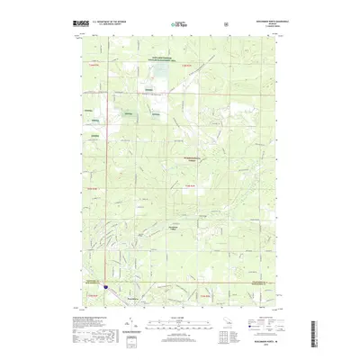
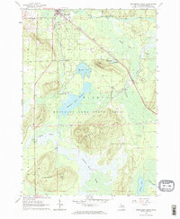
2019 Map of Roscommon North
USGS Topo · Published 2019About this map
The South Branch Au Sable River meanders through the heart of this landscape, a renowned waterway that defines the northern Michigan character of this region near the Crawford and Roscommon county line. The village of Roscommon sits at the southern edge of the survey, serving as a gateway to the extensive public lands of the Huron National Forest and the Kirtlands Warbler Wildlife Management Area. These protected areas provide a refuge for rare species and a haven for outdoor recreation, featuring numerous transit routes such as the Shore to Shore Trail and the MI Shore-To-Shore Horse&Hike. Local landmarks like Chase Bridge and Steckert Bridge cross the river, while the Pioneer Cem offers a point of interest for genealogists. The settlement at Deerheart Valley and the myriad of named forest roads and trails, such as W Pere Cheney Rd and W Gobblers Trl, illustrate the integration of community life with the surrounding wilderness.
Find a feature on this map
112 named features on this map. Tap any name to fly to it.
Don’t see what you’re looking for? This feature index may not catch every label — zoom into the map to look around manually.
Map Details
Editions of this 2019 Roscommon North Map
This is the sole edition of this map. No revisions or reprints were ever made.
Other maps of this area
1949 · Grayling
USGS Topo · 1:62,500
1950 · Grayling
USGS Topo · 1:24,000
1950 · Roscommon North
USGS Topo · 1:24,000
1951 · Wakeley Lake
USGS Topo · 1:24,000
1951 · Grayling
USGS Topo · 1:24,000
1951 · Roscommon North
USGS Topo · 1:24,000
1951 · Pere Cheney
USGS Topo · 1:24,000

1954 · Traverse City
USGS Topo · 1:250,000

1958 · Traverse City
USGS Topo · 1:250,000
1963 · Roscommon South
USGS Topo · 1:24,000
Featured Places
- Roscommon, MI
- Higgins Township, MI
- Beaver Creek Township, MI
- Deerheart Valley, MI
- Grayling Charter Township, MI