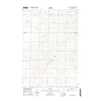
2015 Map of Rose Hill Cemetery
USGS Topo · Published 2015About this map
Coteau des Prairies, a vast plateau of glacial origin, defines the rolling upland landscape of this northeast South Dakota region. The terrain is characterized by numerous small depressions and high ground, crossing the boundary between Marshall Co and Day Co. Water drainage is primarily captured by the winding course of Antelope Cr, which snakes through the southern half of the quadrangle. A rigid grid of section lines and gravel roads, including 126th St and 427th Ave, organizes the agricultural interior, providing access to the scattered cemeteries that serve as the primary markers of local history. The map captures a quiet rural continuity where the land's geological character remains the dominant feature over century-old settlement patterns.
Find a feature on this map
26 named features on this map. Tap any name to fly to it.
Don’t see what you’re looking for? This feature index may not catch every label — zoom into the map to look around manually.
Map Details
Editions of this 2015 Rose Hill Cemetery Map
This is the sole edition of this map. No revisions or reprints were ever made.
Other maps of this area

1953 · Milbank
USGS Topo · 1:250,000

1958 · Milbank
USGS Topo · 1:250,000

1958 · Spain
USGS Topo · 1:24,000

1958 · Britton 4 NW
USGS Topo · 1:24,000

1958 · Britton 4 SW
USGS Topo · 1:24,000

1958 · Langford
USGS Topo · 1:24,000

1958 · Pierpont
USGS Topo · 1:24,000

1970 · Britton 4 NE
USGS Topo · 1:24,000

1970 · Britton 4 SE
USGS Topo · 1:24,000

1973 · Lynn Lake
USGS Topo · 1:24,000